IBM and NASA Unveil Open-Source AI Model to Unlock Decades of Lunar Data
The two organizations have jointly developed a foundation model that processes observations from multiple lunar instruments to help researchers identify craters, volcanic features, and potential ice deposits on the Moon's surface.
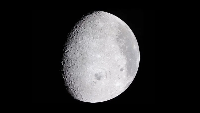
Scientists have accumulated vast quantities of lunar information through decades of observation efforts, yet the challenge of converting raw maps and imagery into actionable insights persists. To address this gap, IBM and NASA have unveiled an open-source artificial intelligence model aimed at enabling researchers to identify craters, map volcanic structures, and locate regions where lunar ice might be present. Known as the NASA-IBM Lunar Foundation Model, this system analyzes data gathered by numerous instruments operating at varying resolutions, establishing a common foundation that researchers can build upon for specialized lunar investigation applications.
The release offers developers and research institutions a pre-trained model alongside a machine-learning-ready dataset, potentially streamlining the effort needed to gather information and construct a lunar-mapping system without starting from the beginning.
AI model combines decades of lunar observations
Instruments and sensors have produced petabytes of Moon-related information. Traditionally, researchers have examined these materials by hand or employed machine-learning systems built for individual applications, as noted in IBM's statement.
The foundation model underwent training to recognize patterns across various lunar data types and resolutions. Rather than constructing a unique system for each investigation, researchers are able to customize it to address particular scientific inquiries.
Google has pursued a comparable strategy for scientific information through WeatherNext 3, which merges satellite and surface-based observations to create hourly weather predictions.
NASA has spent decades building an extraordinary scientific record of the Moon, but collecting data is only part of the job
Kevin Murphy, NASA's chief science data officer and acting chief data and AI officer
Alongside the model, IBM and NASA have introduced what they characterize as the inaugural open-source lunar dataset combining multimodal and multiresolution information in a machine-learning-ready structure. This initiative aligns with a wider movement among tech firms and academic organizations to create open AI models for scientific purposes.
The dataset comprises over 30 spatially aligned layers sourced from nine instruments spanning four missions. Data originates from NASA's Lunar Reconnaissance Orbiter, Gravity Recovery and Interior Laboratory and Lunar Prospector missions, as well as observations from Japan Aerospace Exploration Agency's SELENE mission, referred to as Kaguya.
Model targets ice, craters and volcanic features
A significant use case involves pinpointing locations where subsurface ice might be found. Regions that remain perpetually in shadow present observation difficulties, yet lunar ice could supply water and oxygen for prospective settlements. Additionally, it might be processed to create propellant for spacecraft venturing deeper into the cosmos.
In a research publication co-authored by IBM and NASA scientists, the model achieved a reduction in root mean square error of up to 22% relative to the SwinV2-B image model when forecasting zones with strong potential for lunar ice.
Testing also involved Irregular Mare Patches, distinctive structures that researchers examine to comprehend the Moon's volcanic and thermal characteristics. When dealing with imperfect labels, the model showed a 3% improvement in delineating these formations' boundaries compared with SwinV2-B.
Identifying craters constitutes an additional possible application. Operating at meter-scale resolution, the model demonstrated accuracy matching current specialized techniques while delivering superior efficiency and reduced fine-tuning expenses.
At a larger contextual scale of roughly 100 meters, it surpassed SwinV2-B by nearly 19% while requiring half the training data volume, per the research document.
Crater mapping supports scientists in determining the age and makeup of lunar terrain. It also aids mission planners in spotting gradients, rocks and other dangers as NASA readies for upcoming surface operations in preparation for the Artemis II crewed lunar orbit mission.
The findings derive from investigations performed by the organizations that created the model. Before its effectiveness across broader applications becomes evident, independent researchers will need to evaluate it using additional datasets and scenarios.
What the release means for developers
The Lunar Foundation Model becomes part of IBM's Prithvi collection of open models, encompassing weather, geospatial analysis and heliophysics. The objective is furnishing adaptable AI foundations that researchers can adjust for specialized scientific endeavors.
Research groups can now commence with a model previously trained on an extensive set of aligned lunar observations rather than independently gathering each data source. Unrestricted access additionally permits developers to examine the system, validate its stated findings and construct applications leveraging the accompanying dataset.
Before implementation, developers and research teams should verify that the model's training scope, obtainable data formats and geographic resolution align with their specific requirements. Its predictions should subsequently be evaluated against recognized approaches and firsthand measurements, particularly when assessing ice likelihood, surface conditions or rock formations.
The availability of this model could diminish the technical and computational obstacles to developing specialized lunar-analysis systems, though its ultimate utility hinges on whether independent researchers can validate the announced outcomes. At this stage, it should function as a research platform rather than a substitute for direct scientific measurement or mission-focused verification.
Read more

Identity governance faces new test as AI agents proliferate across enterprises
Autonomous AI agents are forcing organizations to rethink how they manage access and permissions at machine speed. SailPoint's Navigate conference will explore how identity security must evolve to handle this expanding population of non-human actors.

Vertical AI and Purpose-Built Hardware Drive Next Wave of Technology Growth
Specialized AI systems tailored to specific industries are emerging as the primary engine for the next phase of technology expansion, according to insights from the Bank of America Private Tech Trailblazers Conference 2026.

CrowdStrike and CoreWeave Partner to Automate AI Security at Machine Speed
As cyberattackers breach systems in seconds, CrowdStrike and CoreWeave are embedding automated defenses throughout AI infrastructure, turning attacks into training data for faster response.